taken by aerial costal survey planes in 1920 and 1933. The images were taken from the Coastal and Hydraulics Lab website.
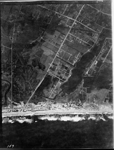
Stockton Lake in 1920. Ourhouse wasn’t built until 1946 (just like me). The site is just to the right of the center of the photo.
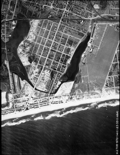
Getting crowded. Not the large diamond shaped white area just below the center. That’s all filled marsh, as is most of the beach area, site of the current baseball fields.
Larger copies of these and other photos can be seen at the web site or on our Flickr site.
Some change, huh?